|
NORTH YORK MOORS - Hawnby
Hawnby & the Hambleton Drove Road
Well off the beaten track, this walk takes you through a mix of wooded dales and open moorland, with a surprise bonus near the end.
As featured in Country Walking magazine - Feb 2010
Fact File
|
Distance
|
16.8km/10½ miles
|
|
Time
|
4½ hours
|
|
Map
|
OS Explorer OL26 North York Moors West
|
|
Start/Parking
|
near Hawnby Church (grid ref SE 537897)
|
|
Terrain
|
Field and moorland paths, bridleways, and minor roads 
|
Grade
|
**** (moderate/strenuous)
|
|
nearest Town
|
Helmsley
|
|
Refreshments
|
Inn (The Hawnby Hotel) and Tearoom/shop (open till late) in Hawnby
|
|
Toilets |
none
|
|
Public Transport
|
Moorsbus M9 from Helmsley/Osmotherley in summer months (Sun & BH March - Oct; also Wed July - Sept)
|
|
Suitable for
|
for everyone.
|
|
Stiles
|
8
|
- (Start) Just east of the church a footpath sign indicates the way across a footbridge over the river. Bear right as indicated to a gate near a corrugated iron shed and pick your way up the hillside through thistles and nettles. It is a steady pull and a bit muddy in places where water springs from the hillside. Cross straight over a farm track and continue up hill. As the gradient easies bear left over a stile and head towards the barns of Sunnyside Farm. Bear right towards the farm up to a bridleway sign for Daletown Common.
- (1.5km, 1mile) Double back right and follow this stony farm track up towards woodland. Near the trees the track forks – you can take either, but we treated it as a section of ‘dual-carriageway’ and kept left! Beyond the trees the land levels out and the tracks converge before a gate and some barns – High Buildings on the map. Continue across this upland pasture, grazed by hardy cattle. You are now over 300m (1000ft) above sea level. After another gate and stile, swing left (south) past the end of a belt of woodland to reach more gates and a crossing of ways at a wall corner. This time do not go through, but turn right to follow a bridleway alongside the wall. At the end go through the gate to find yourself on the old Hambleton Drove Road.
- (5km/3¼miles) Turn right to follow the Cleveland Way along this ancient road – a surfaced path parallels the rutted track along the edge of Boltby Wood. After skirting woodland you emerge onto open moor, and in a further kilometre reach the edge of the escarpment overlooking the villages of Kepwick and Nether Silton. A gate on the left indicates where a narrow metalled lane climbs up from Kepwick – there may be one or two cars parked here. (This road – a rough track ‘unsuitable for motor vehicles’ – continues east across the moor and, if necessary, provides a direct return route back to Hawnby via Arden Hall.) On a clear day the Pennines are visible west across the Vale of York, with Penhill at the entrance to Wensleydale prominent. An information board provides details of the flora and fauna of the area. Here is a good place to stop for lunch and take in the panorama. Depending on weather conditions you may decide to sit on the other side of the wall, near the Kepwick Road.
- (8km, 5 miles) After a break continue north for about ¼ mile (0.5km). Almost opposite a gate in the wall, turn right along a grassy track. This clear path climbs over the moor, and at a fork, branch left to a gate and turn alongside the wall with the view down Thorodale opening out ahead. The path then turns left and steeply descends through bracken into the dale. At the bottom the path picks its way across boggy ground and crosses a stream a couple of times. As you approach the wooded part of the dale tak the left fork as indicated by the waymark and climb up alongside the wood. Keep to the right at a fork to reach a gate.
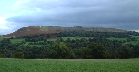
- (10km, 6 miles) Go through the gate and proceed along the track through Thorodale. Tree-felling operations have created a scene of devestation in places, and the track is badly rutted but press on and things improve. After passing Arden Hall down to your right, the trees give way to open fields . Across the valley rises Hawnby Hill – looking impressively like a small mountain. At a gate turn left up to Mount Pleasant Farm, and there turn right to follow the track between the buildings.
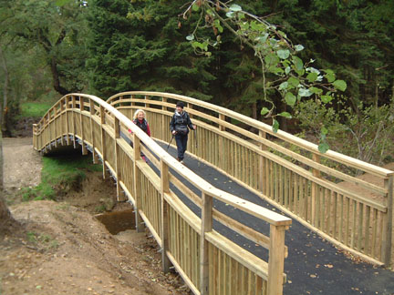
- (12km, 7½ miles) Where the farm track goes left, go right over a stile along a footpath, which turns down through Half Moon Plantation to a footbridge over a stream. Immediately across this bridge go left through a gate to follow a bridleway across another bridge down to the bank of the River Rye. Walk upstream and cross the river by a substantial bridge, built to replace one destroyed by floods. There now follows a steady climb straight up through the trees. Go through a gate on the left and continue up a field side, crossing into the next field at another gate and maintaining direction up hill past a small pond to reach a small gate near Hill End House.
- (13km, 8¼ miles) Here you can turn right and head straight for Hawnby, skirting the flanks of Hawnby Hill. However, by the gate another notice gives access information and this ‘little mountain’ is much too tempting to miss.
 Most of Hawnby Hill is now open access following introduction of the CROW Act. Most of Hawnby Hill is now open access following introduction of the CROW Act.
So turn left and follow a path that bears right towards the northern end of Hawnby Hill. From there a very faint path climbs steeply up the crest of the ridge – it is steep – you may need to use hands as well as feet now and again – but it is worth it. This 1km long ridge stands isolated from the surrounding moors and at almost 300m (1000ft) above sea level, the all-round view from the top is truly amazing. To north and east the moors reach the horizon, with the Bilsdale TV mast prominent, whilst to the south the green wooded valley of the River Rye leads the eye towards Reivaulx and Helmsley. To the south and west you can pick out much of the route of this walk.
- (14.5km, 9miles) After passing a cairn, you start a long descent down to Hawnby – you may well be able to spot your car down to the right. The going steepens as you drop down to a gate where you join the lower path from Hill End House. Go downhill and through a gate by a barn, after which a rough lane leads into Hawnby village opposite the inn – the Hawnby Hotel. To return to your car, turn right past the hotel and walk along the lane past Manor Farm. In a further 200m (220yds) you can either take a footpath left down a field or continue along the lane and then turn left at the road junction at the end. (16.5km/10¼ miles)

Along the Way
Hawnby is a small settlement scattered around a triangle of narrow lanes below Hawnby Hill. It is well off the ‘beaten track’ and has little to attract visitors – although the Hotel attracts plenty of custom at weekends. The surrounding countryside, of hills, woods and valleys, does have a definite unspoiled charm about it.
This part of Ryedale was devastated by a flash flood on June 19th 2005 following a thunderstorm over the moors. Forty-two footbridges were destroyed, together with the two road bridges into Hawnby from the south. All of the footbridges had to be replaced and two road bridges rebuilt. The banks of the river are still littered with treetrunks and debris swept down by the floodwaters.
Hambleton Drove Road was probably established in medieval times, and was part of network of green lanes used to drive sheep and cattle from the north and Scotland to markets serving the expanding centres of population further south. One of several inns on the drove road, Limekiln House, once stood near point 4 on this walk. Today this old road is again busy but with walkers and cyclists – and the occasional ‘off-road’ vehicle.
Arnold Underwood & Caroline Gowthorpe (June 2004), Updated Oct 2006 and July 2009
|


