|
NORTH YORKSHIRE - Off the beaten track
The Hambleton Hills - Three villages and an Abbey
An enjoyable winter walk where for the most part you will be sheltered from the cold northerly wind by following paths through the wooded valleys that cut into the Hambleton Hills between Helmsley and Sutton Bank. There is also the option of visiting the majestic ruins of Rievaulx Abbey
Fact File
|
Distance
|
13.5km (9 miles)or 11.2km (7˝ miles) by missing out the loop to the Abbey
|
|
Time
|
4/5 hours (not including visiting Rievaulx Abbey)
|
|
Grade
|
** moderate
|
|
Map
|
OS Explorer OL26(North York Moors West)
|
|
Start/Parking
|
By the Green in Scawton (Grid. Ref: SE 549 836)
|
|
Terrain
|
Field paths, bridle-ways, and minor roads. Several short but steep ups and downs.
|
|
nearest Town
|
Helmsley
|
|
Refreshments
|
The Hare Inn at Scawton; Tearoom at Rievaulx Abbey (restricted opening in winter) |
|
Toilets |
Rievaulx Abbey (restricted opening in winter)
|
|
Public Transport
|
Moorsbus to Rievaulx (Summer only) |
|
Suitable for
|
for everyone.
|
|
Stiles
|
6
|
- (Start) From the green in Scawton, near the church, take the footpath due west into pasture. Bear left to enter the next field and continue forward dropping down into a shallow valley at the end of the woodland on your right. Swing round the tip of the wood to climb up to a stile by a gate at the top of the bank. Turn left to continue along the field sides to a stile onto a track. Continue straight on, over another stile and across the field to another stile hidden behind a tree. Cross and follow the path left, which descends diagonally down into Flassen Dale. Angling left across the farm track pick up a faint path up the other side of the dale. This path swings right, up the hillside, and can be slippery and overgrown with brambles. At the top you encounter a farm track and again cross over to walk down the right-hand side of fields into Cold Kirby.
- (2.2km, 1˝ miles) Numerous paths radiate from Cold Kirby. From the seat on the green take the lane due east along the left-hand side (not the Cleveland Way). Turn left as indicated by a bridleway sign, to walk up a gravel drive between houses to a gate by the barn at the rear of the property. This leads into fields. You drop down passing a drinking trough and past an enclosure for pigs, to a gate into the next field. It can be muddy hereabouts and there may well be cattle in this field. Keeping along the left-hand side of the field - although deviations might well be needed to avoid the mud - you arrive at a gate onto the Old Byland road. Turn right here and enjoy the next mile as you stride down the lane into the village. There are wide ranging views with prominent to the north the dome shaped Easterside Hill and beyond that Bilsdale TV Transmitter. The lane dips into Old Byland - note that 'Old' has been added to the sign as an afterthought. Ignore the first bridleway sign, and continue past Valley View Farm (B&B), which surprisingly, is also home of ample-bosoms.com! (Leaflets available from in the porch).
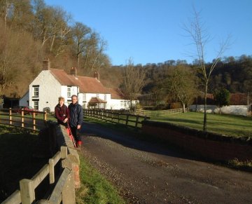
- (4.5km, 3 miles) At the next bridleway sign (opposite a road junction) go through the gate on the right to drop down bearing left below a wall. A narrow path, slippery in places, with a steep drop to your right, gradually descends into a wooded dale. The shaded upper reaches of this dale do not get much sun, so the valley floor can be quite wet underfoot, but after a gate the valley begins to open out and the walking improves. In about ˝ mile you come to a concrete farm road coming down from Reins Farm. Turn left and follow this track as it climbs steadily out of the dale to meet the road from Old Byland. Just before the road, note a wooden bridleway sign on the right. This indicates a faint path that picks its way through the trees back down into the dale to rejoin the road further on. However you may prefer to do as we did, follow the road all the way down. At the bottom of the hill, the bridleway rejoins the road after which you soon arrive at Ashberry Farm and the bridge over the beck. This is a delightful setting. You are now only about ˝ mile from Rievaulx Abbey and you can continue down to the Abbey by taking the path behind Ashberry Farm. This takes you to Bow Bridge over the River Rye from which you cut back across fields to Rievaulx. From the Abbey walk along the road, turn right following the Cleveland Way, over Rievaulx Bridge and on up the road to the junction by Ashberry Bridge.
- (9.5km, 6˝ miles) Continue following the Cleveland Way up the road towards Scawton. When the road bends left continue through the gate along the Cleveland Way below Noddle Hill. On your right are series of ponds originally constructed as fishponds for Rievaulx Abbey, and now frequented by a large number of ducks. Past the ponds you come to a footbridge and the meeting place a several paths. Do not cross the footbridge but bear left towards a gate. Do not go through the gate either, the track beyond is not a right of way, but head diagonally up the hillside on the left. An indistinct track up the grassy hillside leads you to a gate, beyond which the way becomes more obvious as it continues upwards through trees to meet the Scawton road once more.
- (12km, 8 miles) Scawton village is less than ˝ mile straight on up the road, but a more scenic route can be followed, by going left along the road for a short distance. Where the road begins to turn downhill look out for a footpath sign on the right. Follow this faint path through the undergrowth and it soon drops down to join the farm road to Bungdale Head. This road climbs through the delightful, wooded, Waterfall Gill to emerge into daylight. Go right as indicated by a way-mark on a gatepost to continue above the Gill, eventually swinging down to the right at the head of the Gill. Climb up the other side, where again going can be slippery, through scrub and head across rough pastures towards Scawton. Do not be led astray by animal tracks, but continue straight across to a gate at the rear of a farm. Beyond the gate there is no right of way through the farmyard, so turn left as clearly indicated (to the Hare Inn) on a rough path at the rear of gardens. This path bears right down the side of the inn and the village green is just 100yds down the road.
Along the Way
Scawton is a small village, and like the others encountered on this walk - somewhat off the beaten track. Cold Kirby has a broad village green and Old Byland is also set around a broad green. This is where Monks from Furness Abbey settled, but the site was exposed and too near to Rievaulx, so they moved on to a more sheltered spot a few miles south and there establishing Byland Abbey.
Rievaulx Abbey is, without doubt, one of the country's finest ecclesiastical ruins. This Cistercian Monastry was founded in the 12th century, and the roofless shell that stands today still cannot fail to impress.
Arnold Underwood & Caroline Gowthorpe (Dec 2003)
|